
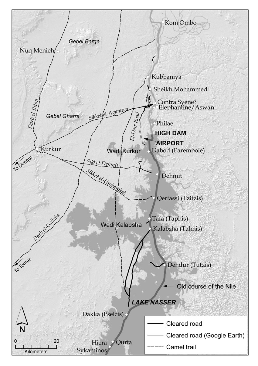
Map of desert roads and trails on the west bank of the Nile in the first cataract region and beyond. The cleared roads are verified in the field, or located with the aid of Google Earth. Sections between Kalabsha and Dakka have been reproduced from Hester et al. (1970: fig. 1). The location of selected routes of camel caravan trails is approximate and based on Survey of Egypt (1949) and Army Map Service (1959). Map: Per Storemyr
Map of desert roads and trails on the west bank of the Nile in the first cataract region and beyond. The cleared roads are verified in the field, or located with the aid of Google Earth. Sections between Kalabsha and Dakka have been reproduced from Hester et al. (1970: fig. 1). The location of selected routes of camel caravan trails is approximate and based on Survey of Egypt (1949) and Army Map Service (1959). Map: Per Storemyr
Discover more from Per Storemyr Geoarchaeology & Conservation
Subscribe to get the latest posts sent to your email.
