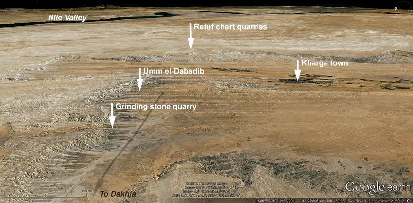
Satellite image showing important places mentioned in the text. This is a strongly tilted view, looking east, the scale only
applicable to areas in the lower part of the image. Long arrow indicates the location of a main desert route, the Darb Ain Amur. Image modified from Google Earth.
Satellite image showing important places mentioned in the text. This is a strongly tilted view, looking east, the scale only
applicable to areas in the lower part of the image. Long arrow indicates the location of a main desert route, the Darb Ain Amur. Image modified from Google Earth.
Discover more from Per Storemyr Geoarchaeology & Conservation
Subscribe to get the latest posts sent to your email.
