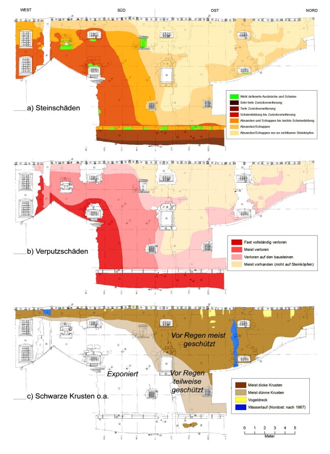
Round tower at medieval city wall St. Gallen (CH), damage overview
Erected in the Middle Ages, stone masonry
Purpose: Basis for conservation measures, relationships between themes
Method: GIS with base map from manual measured survey
Mapping: Per Storemyr and Christine Bläuer, CSC
Base map: Hermann Obrist, IGA Archäologie Konservierung
Client: City of St. Gallen through Berger + Partner AG Architekten FH/BSA
2008
Reference:
Storemyr, P. & Bläuer C. (2008): SG – St. Gallen, Regierungsgebäude, Rundturm, Schadensentwicklung und Gefährdung. Report R.0059.01 Conservation Science Consulting Sàrl, Fribourg (CH), [Evolution of damages and risk assessment at the medieval Round Tower of the Government Building in St. Gallen, Switzerland]
