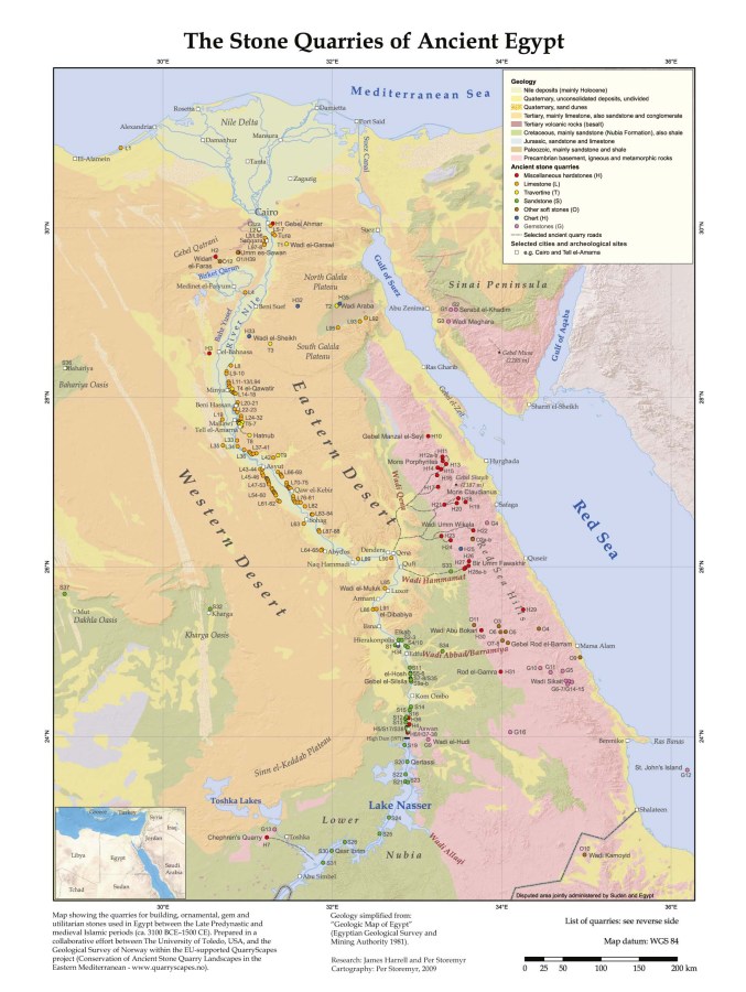
Atlas of ancient Egyptian stone quarries – locations
Purpose: Archaeology, conservation planning
Method: GIS
Research: James Harrell and Per Storemyr
Base map: Based on the Geological map of Egypt and various satellite images and topographical maps
Project: QuarryScapes
2009
References:
Harrell, J.A. & Storemyr, P. (2009): Ancient Egyptian Quarries – An Illustrated Overview. In: Abu-Jaber, N., Bloxam, E., Degryse, P. & Heldal, T. (eds.): QuarryScapes. Ancient stone quarry landscapes in the Eastern Mediterranean, Geological Survey of Norway Special Publication 12, 7-50. Download PDF (7,6 MB)
Storemyr, P., Bloxam, E. & Heldal, T. (eds.) (2007): Risk assessment and monitoring of ancient Egyptian quarry landscapes. QuarryScapes report, Geological Survey of Norway, Trondheim, 207 p. Download PDF (12,8 MB)
