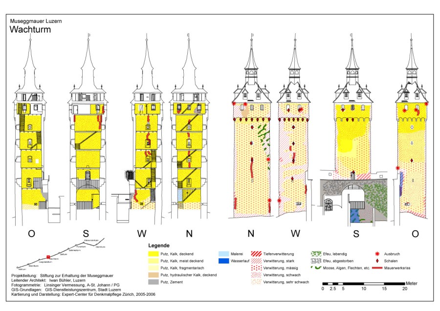
City wall of Lucerne, Wachtturm (CH), damage overview
Erected in the Middle Ages, stone masonry
Purpose: Basis for conservation concept
Method: GIS with base map from photogrammetry/CAD
Mapping: Per Storemyr, Sophie Wolf and Andreas Küng, Expert-Center for Conservation of Monuments and Sites
Base map: Linsinger Vermessung
Client: Stiftung zur Erhaltung der Museggmauer, through Iwan Bühler Architekturbüro GmbH
2006
Reference:
Storemyr, P., Wolf, S. & Küng, A. (2006): Schäden und Gefährdung der Museggmauer in Luzern. Band 1 und Band 2: Karten. Report no. 2006.022, Expert-Center for Conservation of Monuments and Sites, Zürich. Vol. 1: 80 p., vol. 2: GIS-based maps [Damages and risk assessment at the Lucerne City Wall (Museggmauer)]. Download vol. 1 as PDF (14,2 MB). Vol. 1 alternative download. Download vol. 2 as PDF (6,2 MB). View online GIS developed in the project
