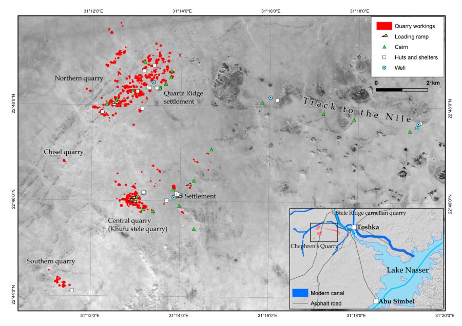
Chephren’s quarry (EG)
Purpose: Archaeology and conservation planning
Method: GIS/GPS
Research/mapping: Per Storemyr, Tom Heldal, Elizabeth Bloxam and Ian Shaw
Base map: Corona satellite image (c. 1965)
Project: QuarryScapes
2009
References:
Heldal, T., Storemyr, P., Salem, A., Bloxam, E., Shaw, I. & Lee, R. (2009): GPS and GIS Methodology in the Mapping of Chephren’s Quarry, Upper Egypt: A Significant Tool for Documentation and Interpretation of the Site. In: Maniatis, Y. (ed.): ASMOSIA VII, Proceedings of the 7th International Conference of the Association for the Study of Marble and Other Stones in Antiquity, Thassos 15-20 September 2003, Bulletin de Correspondance Hellénique supplement, 51, 227-241. Further information
Harrell, J.A. & Storemyr, P. (2009): Ancient Egyptian Quarries – An Illustrated Overview. In: Abu-Jaber, N., Bloxam, E., Degryse, P. & Heldal, T. (eds.): QuarryScapes. Ancient stone quarry landscapes in the Eastern Mediterranean, Geological Survey of Norway Special Publication 12, 7-50. Download PDF (7,6 MB)
