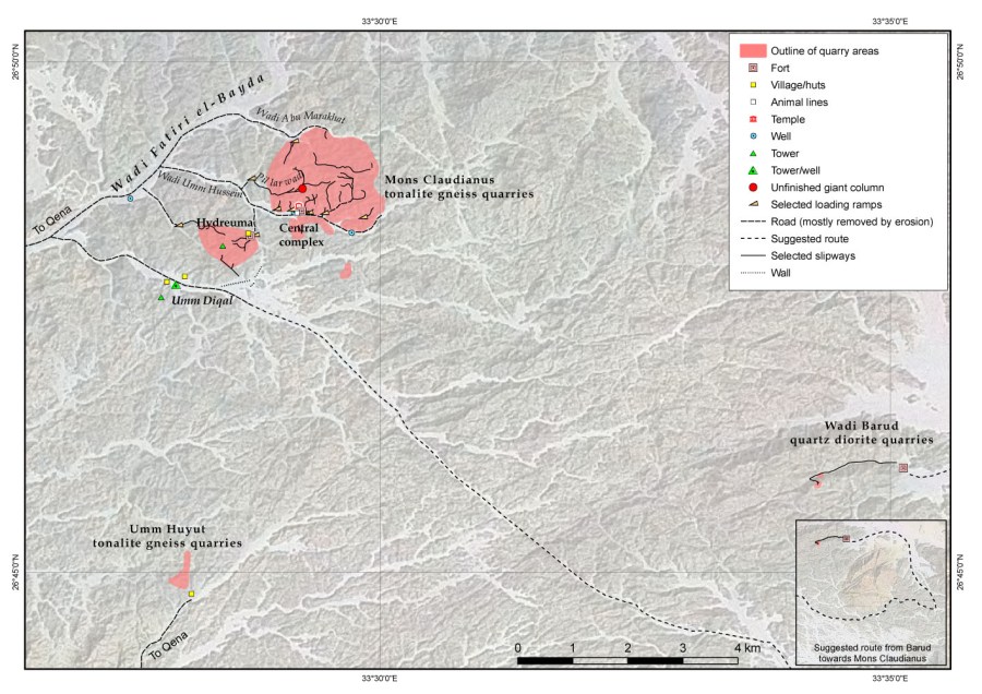
Mons Claudianus ancient quarry landscape, Eastern Desert (EG)
Purpose: Archaeology
Method: GIS
Research: Per Storemyr and James Harrell, based on published sources and visits
Base map: Landsat satellite image (c. 2000)
Project: QuarryScapes
2009
References:
Harrell, J.A. & Storemyr, P. (2009): Ancient Egyptian Quarries – An Illustrated Overview. In: Abu-Jaber, N., Bloxam, E., Degryse, P. & Heldal, T. (eds.): QuarryScapes. Ancient stone quarry landscapes in the Eastern Mediterranean, Geological Survey of Norway Special Publication 12, 7-50. Download PDF (7,6 MB)
