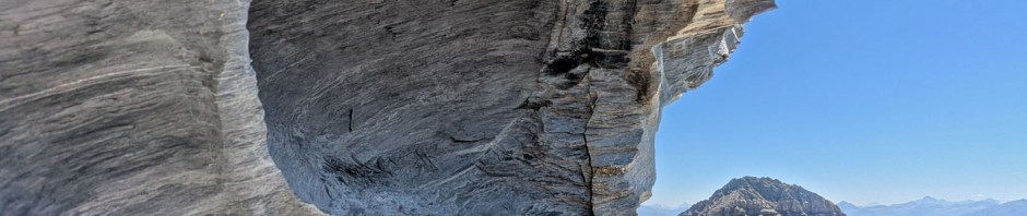
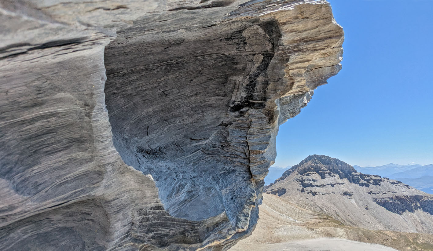
Tafoni in shales at 2700 m. Muttenbergen in Brigels, eastern Switzerland. Photo by PS
To my knowledge, tafoni weathering has hardly been described in rocks at high altitudes in the Swiss Alps. But last summer I came across fine examples in a series of young, slightly metamorphic shales and marlstones of Tertiary age at altitudes of about 2700 m in Brigels, which is in the eastern canton of Graubünden. This summer I set out to investigate more closely. To my joy, tafoni could be observed “everywhere” connected to very exposed peaks and promontories, constituting a significant part of the breaking-up of the rocks. Importantly, in the dry summer, salt efflorescence could also be observed “everywhere” related to tafoni formation. Here’s a brief report.
Geological setting
The slightly metamorphic shales and marlstones in Brigels are part of successions that were deposited at the northern side of the rising Alps in the Tertiary period, first in a shallow marine environment, later in deeper waters as flysch deposits. The flysch is very extensive – and the deposits on which Permian Verrucano (mainly sandstones) was thrust from the south as part of the mountain building process. It gave rise to the famous Glarner Hauptüberschiebung (the Glarus trust), located in the Sardona UNESCO World Heritage Site in Flims-Laax, just to the east of Brigels.
On the Sardona website is a wealth of information, including literature on the regional geology. Numerous geological maps are also available from map.geo.admin.ch. Background information for this article is based on these sources.
My observations were done on hiking tours to outliers of the 30-50 million years old (ma) shales and marlstones, at altitudes between 2500 and 3000 m, some 10 km north of Brigels. These rocks constitute some of the highest peaks and promontories in the study area, including Kistenstöckli (2748 m) and Muttenbergen (ca. 2700-3000 m), both capped by somewhat harder rocks.
Although slightly metamorphic, the rocks are very friable and weather extensively, giving rise to rockslides leaving large scree deposits along the mountain slopes. The current “weathering regime” seems in fact to have been going on since before the last glacial maximum (LGM, ca. 24 ma), as the highest peaks in the area may not have been covered by ice at that time (see map of glaciation at map.geo.admin.ch).
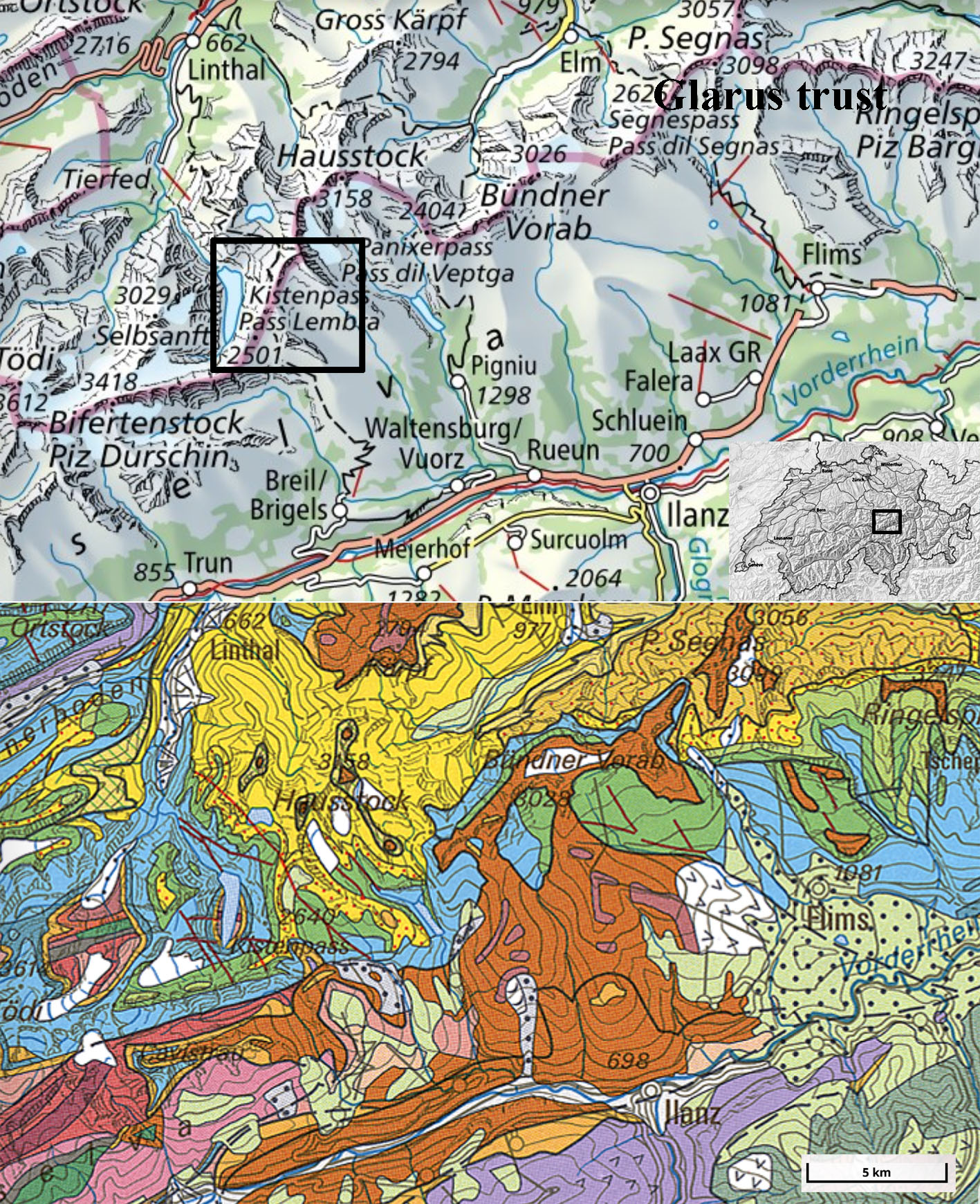
Topographical and geological maps with study area indicated (rectangle). On the geological map, yellow colours show flysch and shale, blue is limestones, and brown verrucano. Source: https://map.geo.admin.ch
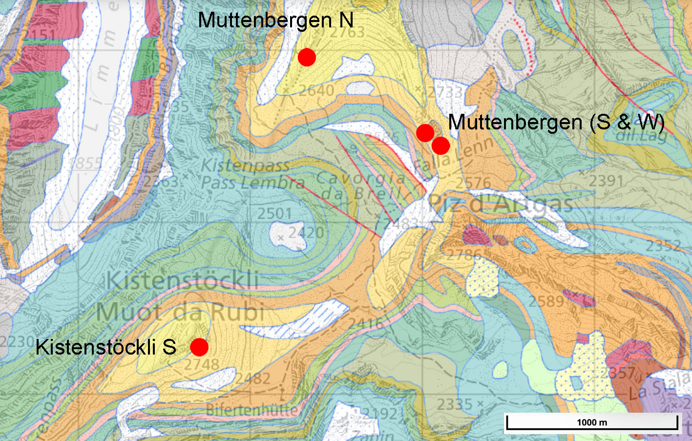
Detailed geological map with main observation spots (red dots). Yellow and orange colours indicate mainly Tertiary deposits. Source: https://map.geo.admin.ch
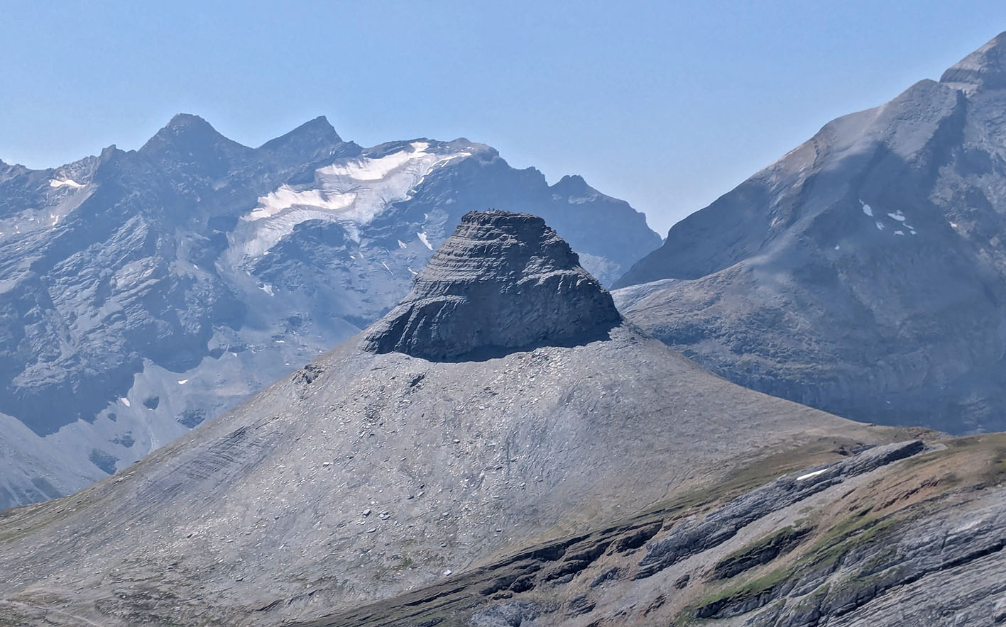
View of Kistenstöckli (2748 m) from the east with its large scree deposits. Photo by PS
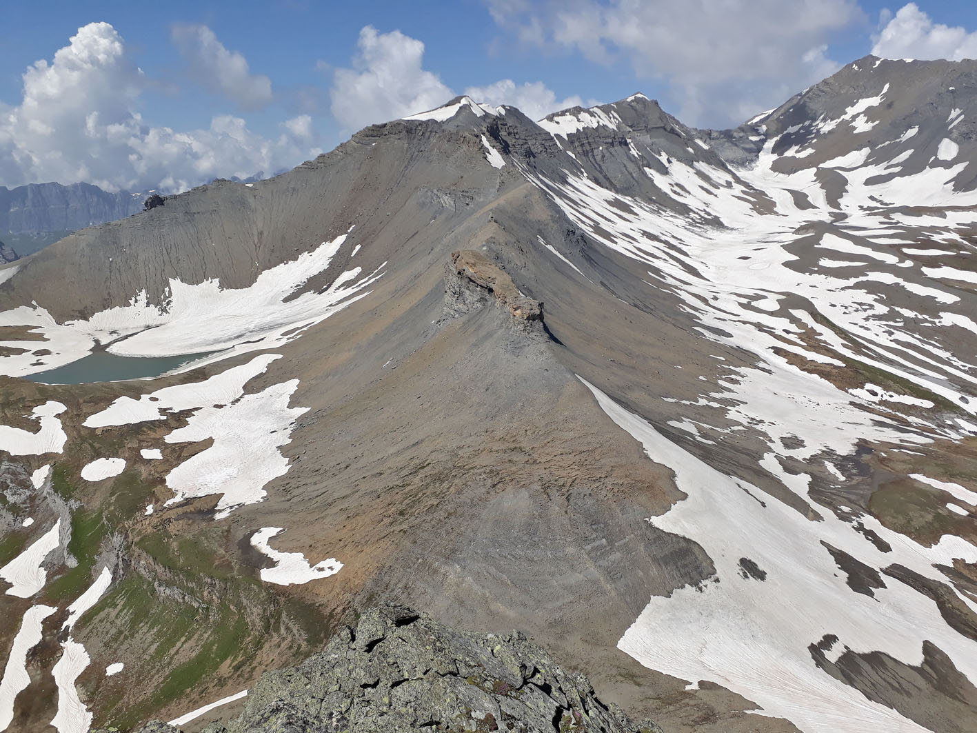
View of Muttenbergen (c. 2700-3000 m) from the south. Photo by PS
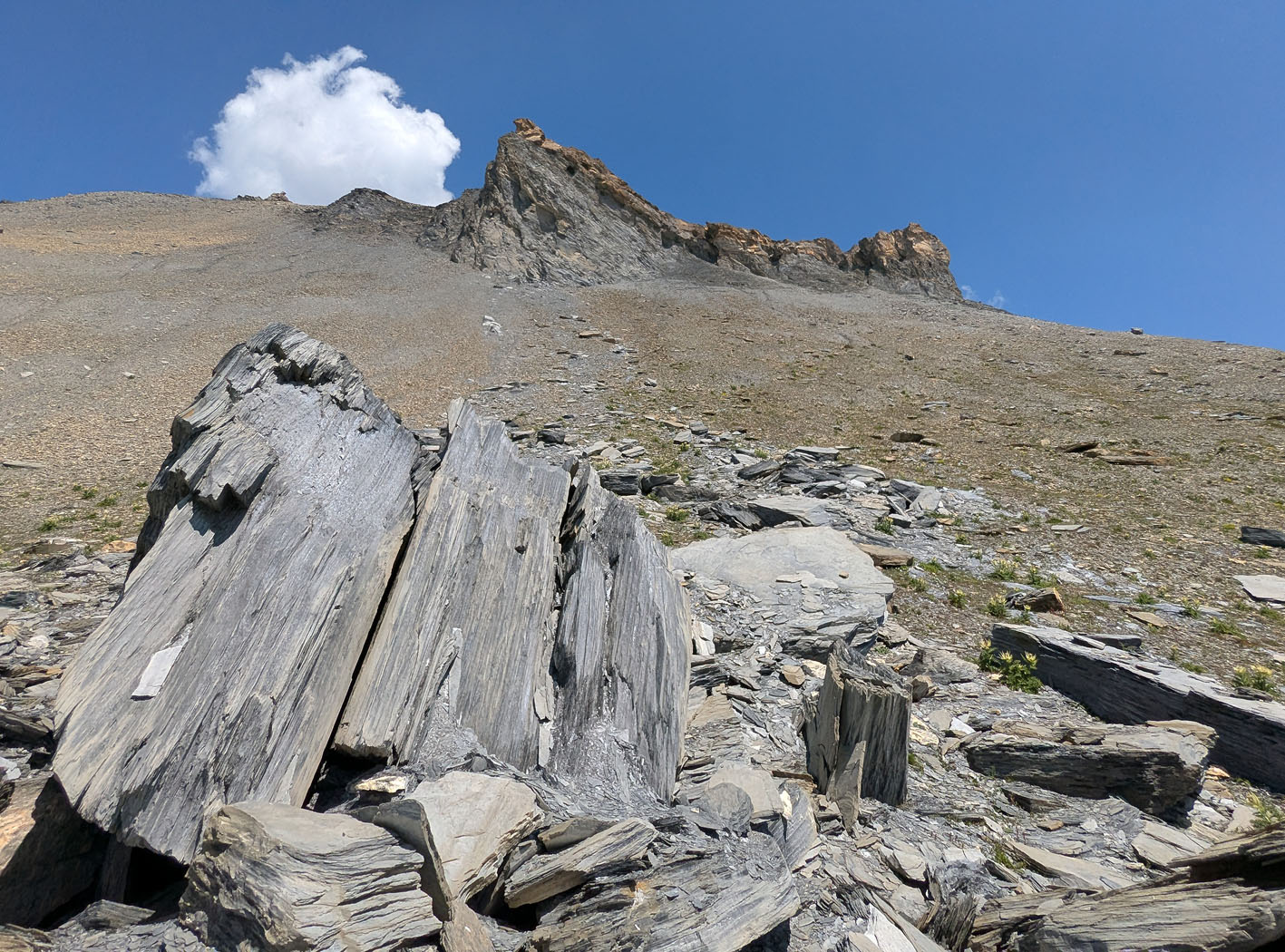
Rockslide from Muttenbergen, some 100 m higher up. Photo by PS
Tafoni and other weathering phenomena
Tafoni is not the only weathering phenomenon in steep cliffs and pinnacles, which are criss-crossed by (semi)vertical cracks and fissures. The thin slate easily breaks up and away, probably mainly by frost, but perhaps also connected to rapid wetting-drying cycles. Moreover, differential weathering connected to salt is pronounced, especially in some successions with rapidly alternating thin layers of shale and limestone, with the latter more resistant and standing out between the shale and marl layers.
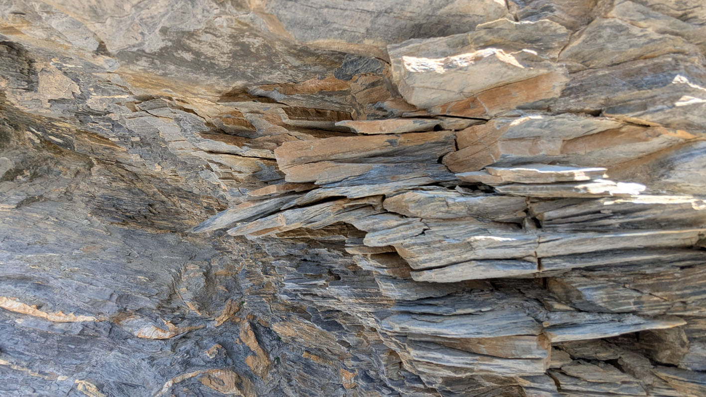
Splintered layers of shale, probably caused by frost (Muttenbergen W). Photo by PS
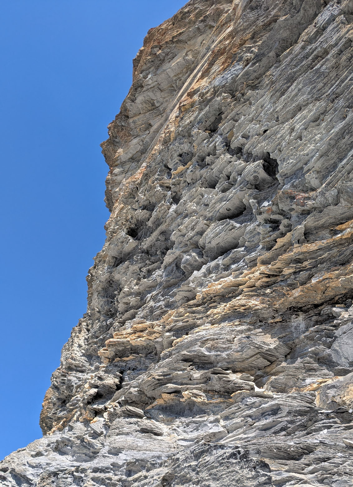
Tafoni and differential weathering in a c. 20-30 m high cliff (Muttenbergen W). Photo by PS
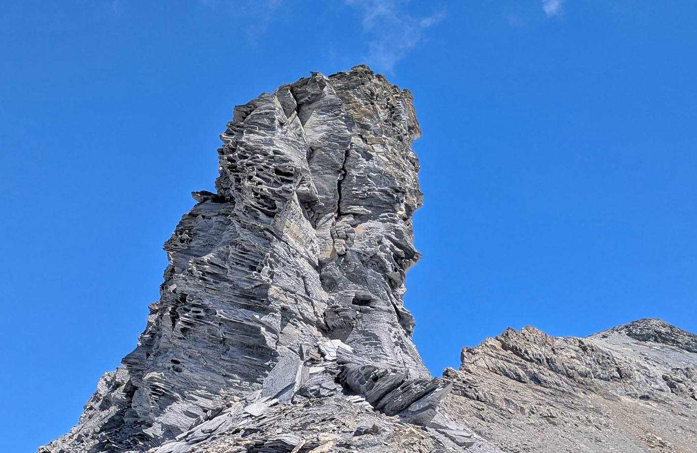
Tafoni and differential weathering in a c. 20 m high pinnacle (Muttenbergen N). Photo by PS
Tafoni is generally found in the steepest, most weather-exposed cliffs, often connected to overhangs, and more on southerly and westerly than other faces. In such locations tafoni occur in all forms and sizes, from small, single holes via connected ones, to holes as large as human heads and beyond. The latter are confined to regular shale successions. Such successions are usually not very thick and, generally, the inhomogeneous character of the rocks, with harder limestone layers, cracks and fissures, prevents the formation of really large tafoni holes.
There are, however, some shallow caverns measuring several metres across. Although it is difficult to discern a clear tafoni component due to rugged surface walls, it is not entirely unlikely that tafoni is partially responsible for the formation, together with general salt weathering.
It seems obvious that tafoni is a significant contributor to the breaking up of the rocks and formation of the morphology of the peaks and promontories. In addition to the slow weathering of the tafoni itself, the holes give access to water and snow during storms and blizzards, implying that it may enhance frost and other weathering phenomena.
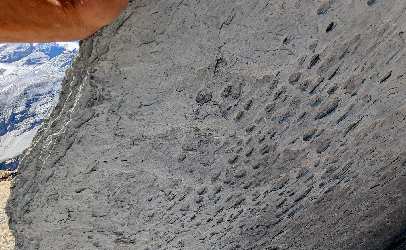
Tiny tafoni holes on the underside of a block of shale (Muttenbergen N). Photo by PS
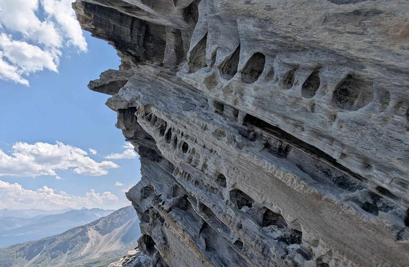
Small-scale tafoni and some differential weathering (Kistenstöckli S). Photo by PS
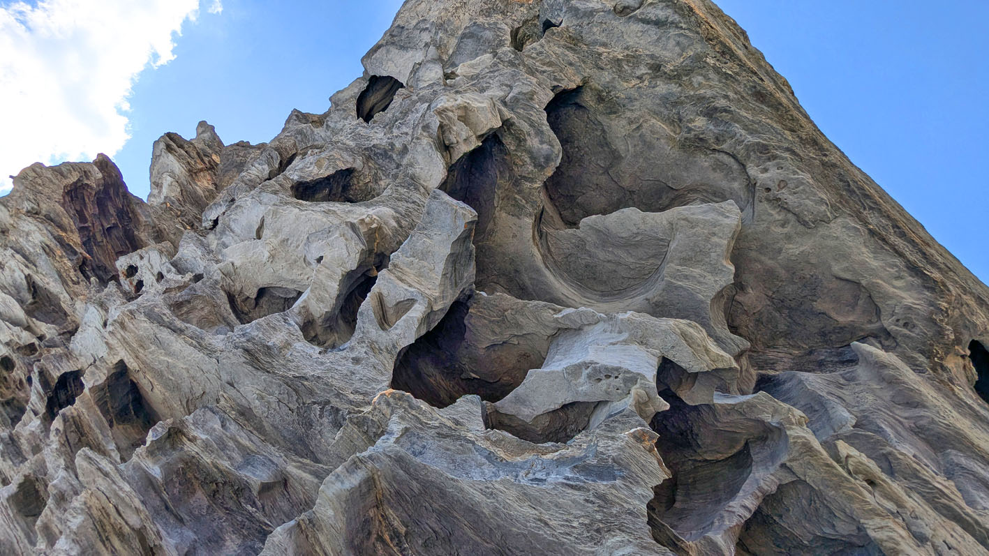
Larger-scale, connected tafoni making the rock look like a Swiss cheese (Kistenstöckli S). Photo by PS
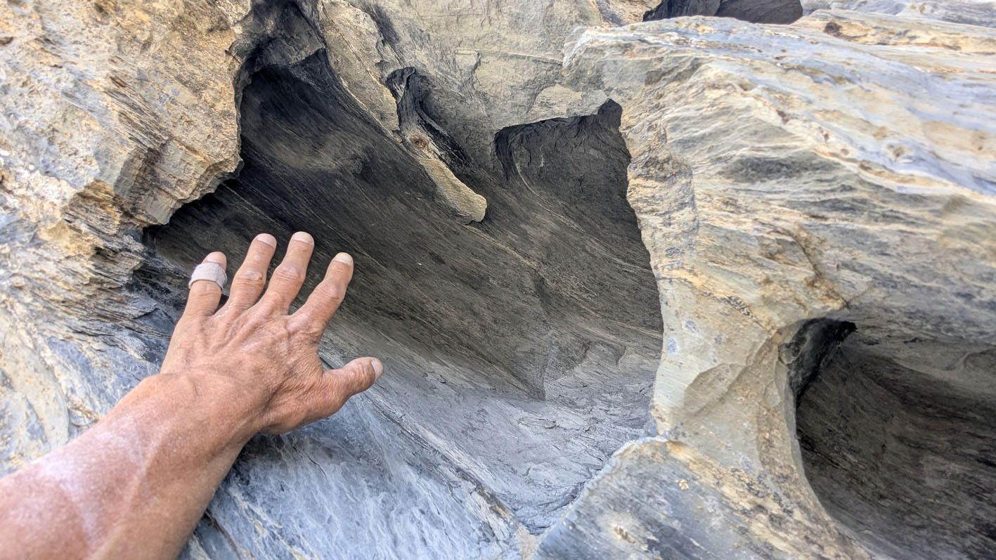
Larger-scale single tafoni hole, possibly developed by growth and collapse of several smaller holes (Kistenstöckli S). Photo by PS
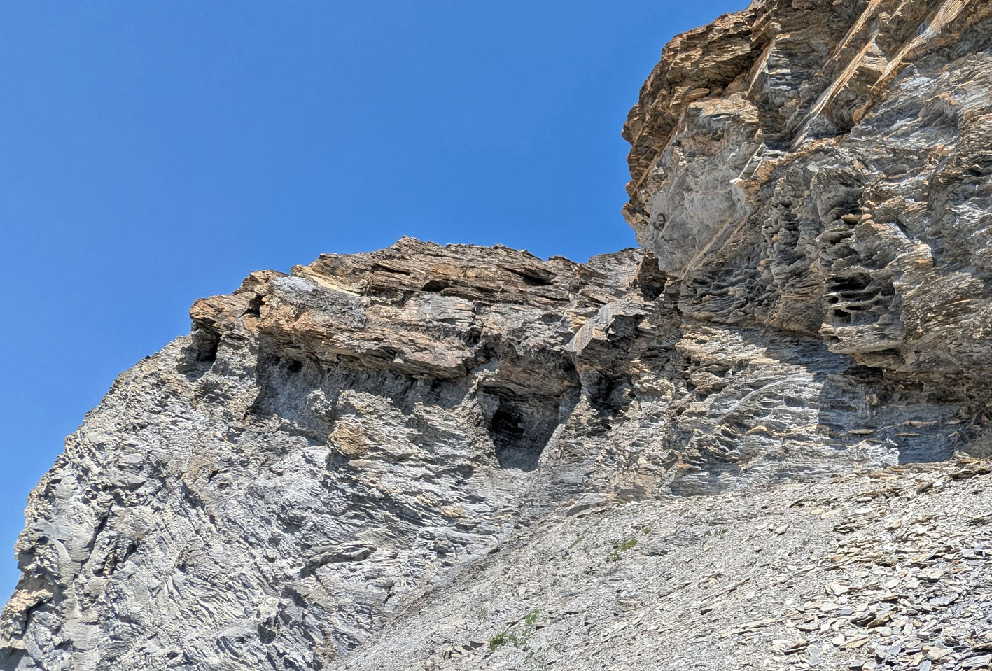
Tafoni (right) and caverns that may have developed partially due to tafoni. Muttenbergen W. Photo by PS
The presence of salts
Tafoni observations were made in the current (2026) very dry and hot European summer. This meant that much more salt than usual could be seen below overhangs – particularly within tafoni and in differentially weathered shale. In sheltered locations salts were practically everywhere, as white powdery efflorescence and white to greyish crusts. Salt is a well-known weathering agent in tafoni formation. It may, however, be difficult to observe so easily with the naked eye as in this case.
Salt analyses were undertaken by simple means: 1) Polarizing microscopy (in oil immersion) of efflorescences and crusts, including powder and splinters of weathered rock; 2) dissolution in deionized water and 10% HCl; 3) determination of pH and anions (sulphate, chloride, nitrate) with test strips. Four samples were scratched from weathered rocks with a knife at different locations, and they all showed a similar pattern:
- Gypsum (calcium sulphate) seems to be the most important salt
- There may be another, undetermined sulphate salt (Mg-sulphate?)
- Some calcite, or Mg-calcite/dolomite, is always present in the samples
- Chloride or nitrate salts were not detected
With gypsum a main salt, direct crystallization after wet periods is probably the main weathering mechanism. Gypsum is not hygroscopic and in most circumstances does not dissolve/crystallize with changes in ambient humidity and temperature alone.
Most of the sulphate salt(s) likely derive from the rock itself, possibly from original chemical deposition and/or via oxidation of small amounts of sulphide and reactions with available calcium and possibly other cations. Tests with dissolution in HCl and subsequent drying showed no formation of sodium chloride, hence sodium is probably not present
Some sulphate may theoretically derive from wind-blown Saharan dust, as has been suggested for Corsican tafoni formation (Brandmeier et al. 2011). Red Saharan dust is not uncommon in Brigels and can be seen on melting snow patches in the summer.
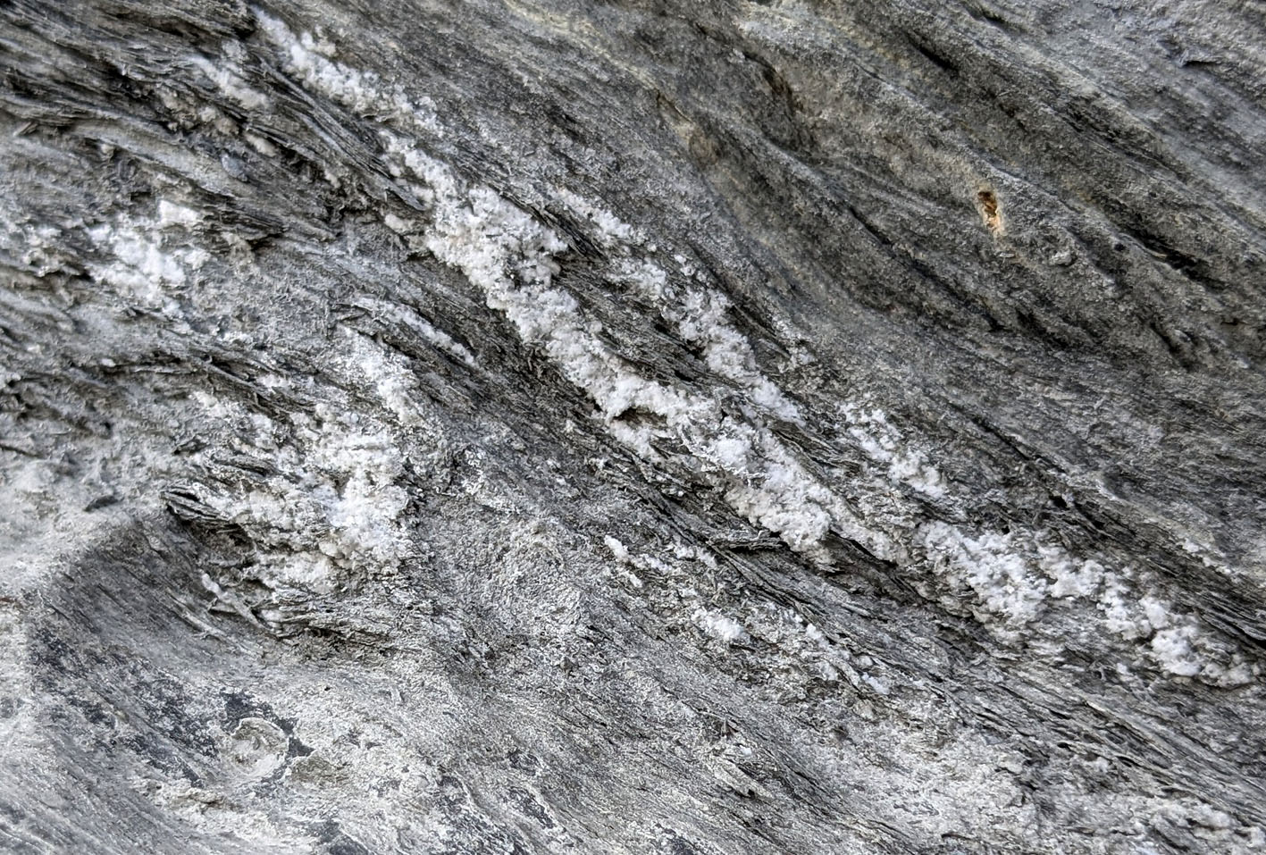
Salt efflorescence in differentially weathered shale (Kistenstöckli S). Photo by PS
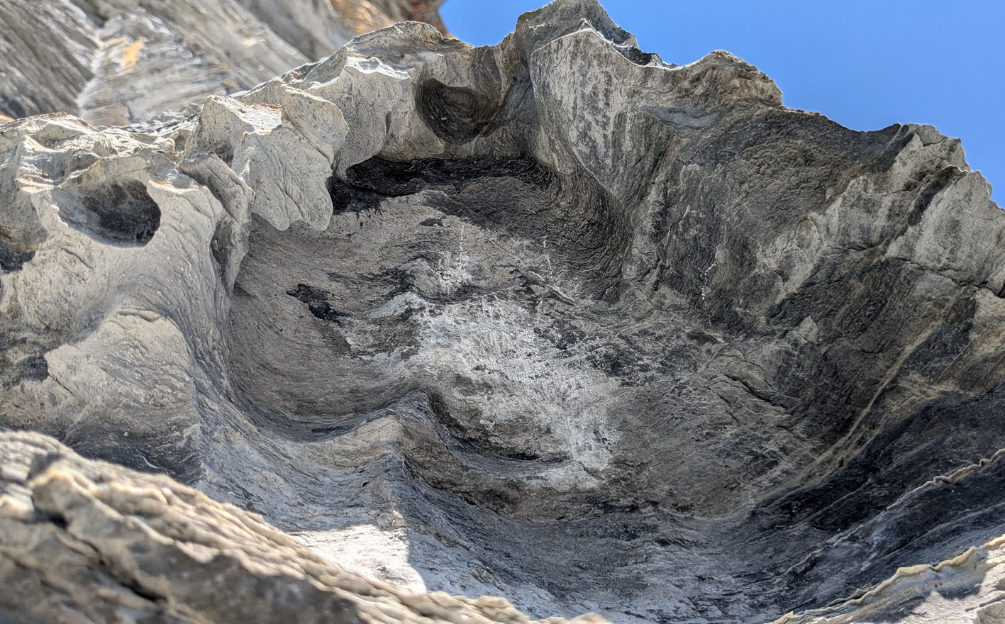
Salt efflorescence within a tafoni hole the size of 2-3 human heads (Muttenbergen S). Scratch marks are from sampling. Photo by PS
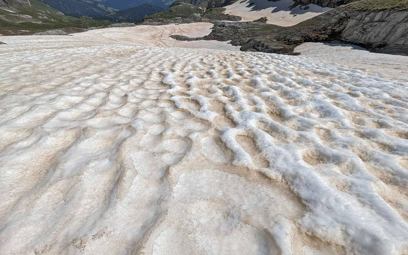
Although salts in the tafoni formation probably mainly derive from the rock itself, sulphates in Saharan dust may be a minor contributor. Here’s a snow patch at 2500 m close to Muttenbergen S in 2024.
Tafoni in a periglacial environment
Given the preliminary nature of the observations, it is yet impossible to date the onset of tafoni formation at the locations described. However, it is likely that tafoni weathering has been significant throughout most of the time since the last glacial maximum (24 ma), probably also earlier – thus generally occurring in a mainly periglacial landscape. Today the mean annual temperature is a little below zero degrees, with yearly precipitation at 1500-1700 mm (see climate normals in CH). There are no (retreating) glaciers in the study area, but several at somewhat higher altitudes in the near vicinity.
Tafoni is extremely widespread in coastal and desert regions, and it is neither unknown in former and current periglacial and glacial landscapes. Prominent examples include the higher reaches of the granite mountains of Corsica (Brandmeier M. et al. 2011, see also Guglielmin M. 2022, in The Mediterranean Islands, a chapter in the book Periglacial Landscapes of Europe, Oliva et al. ed. 2022), as well as ice-free mountains in Antarctica (Ponti et al. 2021, Engvik et al. 2022, Elvevold et al. 2024).
Whatever the exact history of tafoni formation in Brigels may be, our case beautifully demonstrates important requirements for development: 1) vulnerable rocks; 2) the presence of salts, and – not least; 3) windy climatic conditions with rapid and often great changes in temperature and precipitation. This implies that similar tafoni likely occurs at many other places in the Swiss Alps.
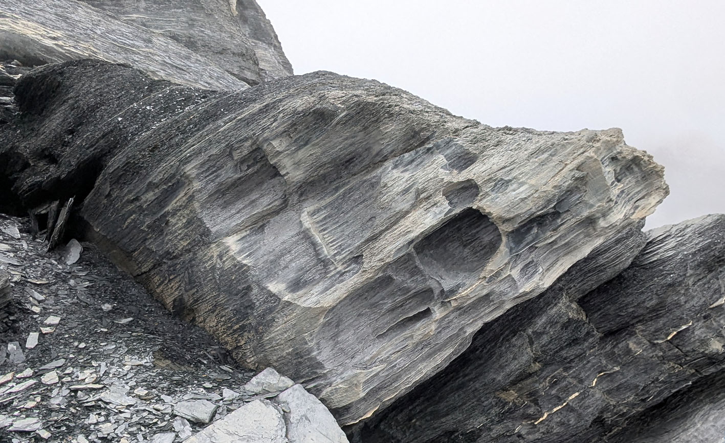
Tafoni on a windy and foggy day in 2025 (Muttenbergen N). Photo by PS
Discover more from Per Storemyr GeoKultur
Subscribe to get the latest posts sent to your email.





Pingback: Observations of tafoni at Costa Vicentina (Portugal) | Per Storemyr Geoarchaeology & Conservation